Anglian Water, in collaboration with Cambridge Water, is progressing with plans for a new reservoir to be established within the Cambridge Fens.
THE Fens Reservoir Project aims to secure a reliable water supply for Cambridge, neighbouring communities, and West Norfolk. The region is among the driest in the UK, and the growing number of technology firms and housing developments is expected to place further demand on existing water resources.
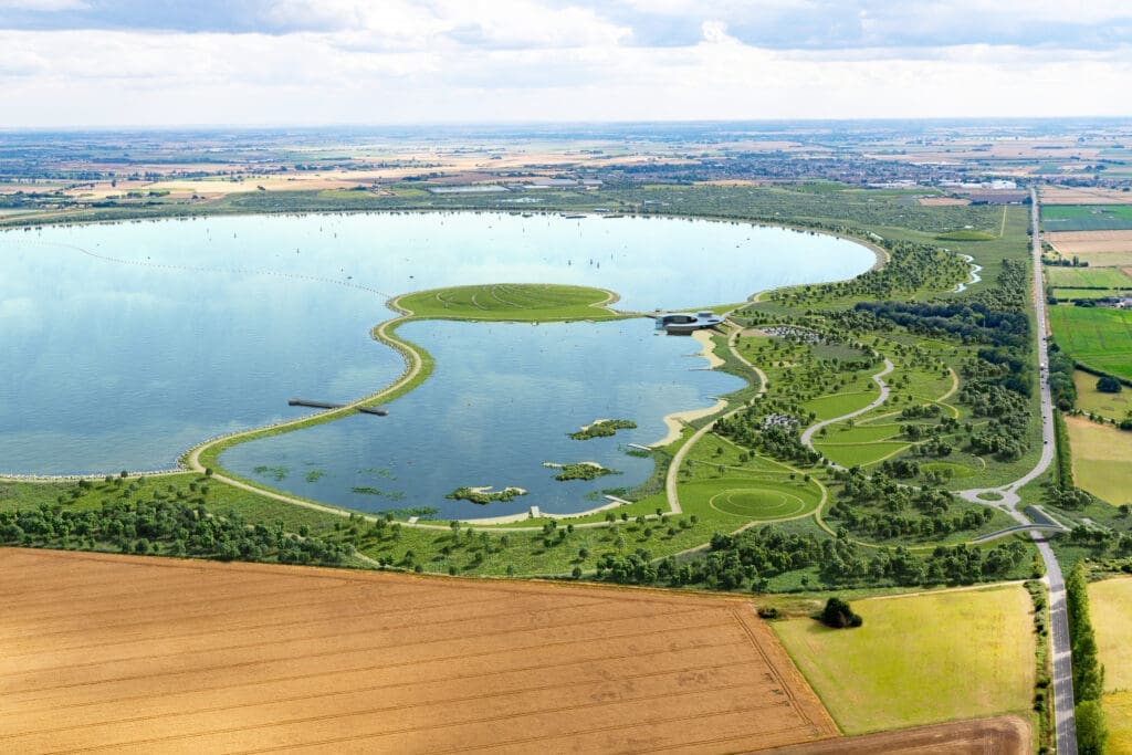
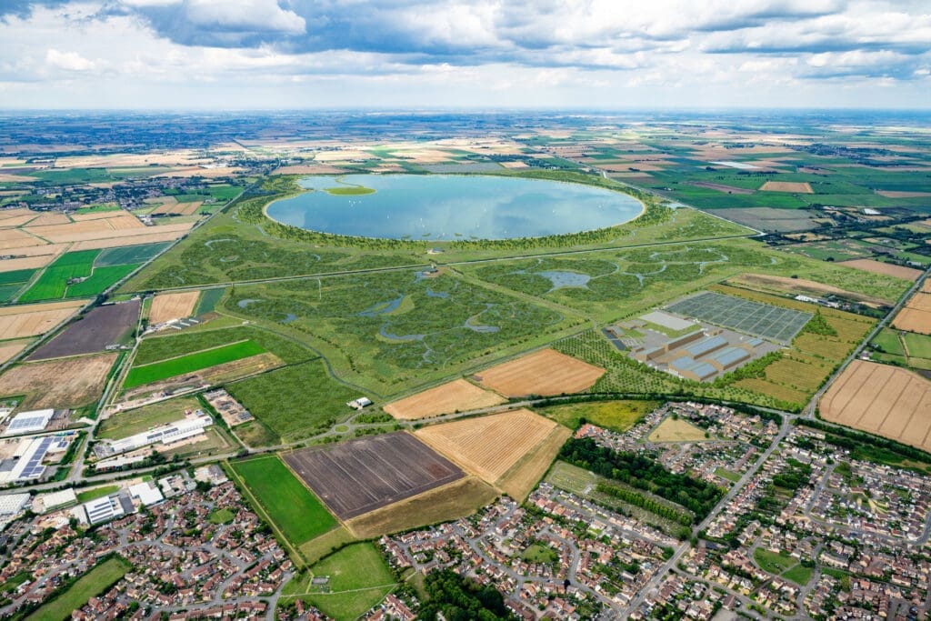
The proposed reservoir will be located to the north of Chatteris, spanning about six square miles, and bordered by two navigable waterways. The 40 Foot River to the south and the 16 Foot River to the east are significant features of the landscape and will shape both the integration of the reservoir into its surroundings and the arrangements for water supply.
Enjoy more Towpath Talk reading every month.
Click here to subscribe & save.
The Inland Waterways Association (IWA) was involved at an early stage of the Fens Reservoir Project, participating as a member of the consultation group formed to offer feedback and guidance on the reservoir’s design, its projected impact on the area, and the effects on local residents and organisations. In October last year, phase three of the proposal was made available for review, and the IWA submitted formal feedback to the project team in early December.
Ongoing local consultation will continue in advance of the Development Consent Order (DCO) application, scheduled for early 2027. The Secretary of State is expected to issue a determination in 2028. If approved, construction would begin in 2030, with water supply operations commencing from 2036.
In response to reviewing phase three, the IWA has raised concerns about the effects on navigation, waterway channels, air drafts, and moorings. These concerns specifically relate to the River Nene and the River Great Ouse, the primary water sources, and the Middle Level navigation system, which will be the conduit for water abstraction and movement both during and after construction.
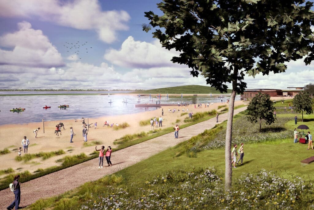
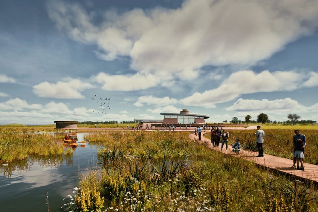
The reservoir is planned to feature a ‘lagoon’ in the top northwest corner, designated for visitor facilities and watersports. The IWA welcomes these amenities and has recommended that infrastructure such as roads, walkways, and utilities be incorporated into the project design early on. Pathways and nature zones are proposed around the reservoir, and IWA has suggested that these zones should also include moorings to improve access for boaters and the general public to and from the rivers that bound the site.

Approximately two million tonnes of aggregates and rock will be required for the reservoir’s construction. Although the adjacent rivers are navigable, no practicable access from seaports has yet been identified. Two potential transport routes have been selected for further consideration, both involving initial movement by rail to local sidings, followed by delivery to the site via HGVs. This latter stage is expected to place considerable strain on local roads and residents, said the IWA, which has proposed amending one preferred route and substituting HGVs with barges to deliver materials directly to the site.
In earlier project phases, water was to be abstracted from the Ouse Washes and transferred to the reservoir by restoring Horseway Channel, a section of the 40 Foot
River, which has been closed to navigation since 2006. The phase three part of the proposal now favours transfer by pipeline, primarily to address concerns over cross-contamination of waterways. The IWA has suggested reconsidering the restoration of Horseway Channel, arguing that reopening the channel and its towpath or cycle path would benefit both boaters and the wider public, particularly by enhancing access to the Ouse Washes, a 30-mile corridor featuring walks and abundant wildlife.
The utility company said the project is designed not only to meet rising demand but also to create new opportunities for local communities and the environment. It has acknowledged that the reservoir would have significant effects on nearby landowners and communities and has stressed that it is committed to working closely with those affected as the project evolves. Recently updated information includes early assessments of construction impacts, traffic and transport options, and measures intended to minimise disruption.
The public can explore the full scope of the proposal through an interactive online map which shows the locations and purposes of all planned elements of the scheme. Although the latest consultation has now closed, the website – https://fensreservoir.co.uk/ – will continue to publish updates as the plans progress.